

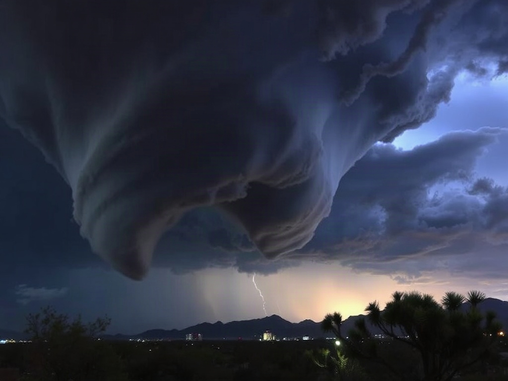

The National Weather Service in Tucson confirmed a funnel cloud was spotted over the Tucson metro area on Friday, August 21, 2026. Officials said the funnel cloud formed around 3:23 p.m. during monsoon thunderstorms and did not reach the ground, developing from a non-supercell thunderstorm typical of the seasonal weather pattern.
The report described the feature as a funnel cloud rather than a tornado, noting it extended about 30 percent of the distance from the parent cloud toward the ground and did not make contact with the surface. The NWS characterized the funnel cloud as non-supercell in origin, meaning it developed from a typical monsoon thunderstorm rather than from a rotating supercell thunderstorm often associated with more intense tornadoes.
The funnel cloud was observed around 3:23 p.m. local time southeast of Tucson, approximately nine miles from the city center, according to an official storm report from the National Weather Service (NWS) Tucson office.
The confirmation came after a viewer submitted photographic evidence to KOLD 13 News, which then forwarded the images to NWS Tucson for verification. Officials said the funnel cloud formed during an active monsoon convective period common in southeastern Arizona during late August. The NWS Tucson Area Forecast Discussions leading up to the event described an active monsoon pattern across the region, with daily chances for thunderstorms in the afternoons and evenings, and variability in timing and intensity. Forecast guidance cited by NWS Tucson indicated storms typically initiate in higher terrain around noon to 1 p.m., spreading across the metro area by mid-afternoon, consistent with the timing of the funnel cloud observation.
The 2026 monsoon season in Tucson has been marked by above-average activity, with the Climate Prediction Center and NWS Tucson’s seasonal outlooks showing a 36% chance of above-normal precipitation and a 45% chance of above-normal temperatures through July to September. Records show that Tucson International Airport had received 1.75 inches of rain through July, ranking as the 46th driest start to the season on record. However, rainfall increased significantly in early to mid-August, with totals across the Tucson metro area ranging from about 0.50 to 2.50 inches, and isolated locations reporting as much as 3 to 5 inches. This spatial variability is typical of monsoon convection and supports the development of localized severe weather phenomena such as funnel clouds.
NWS Tucson’s storm reports from the broader monsoon period document multiple severe weather incidents, including strong outflow winds and blowing dust. Wind gusts recorded during the season ranged from 58 to 88 mph, with a notable 74 mph gust at Tucson International Airport. A separate severe thunderstorm warning event on August 9, 2026, included reports of a funnel cloud near Tucson and a 60 mph thunderstorm wind gust, illustrating that funnel clouds were among several severe weather features observed during the season.
Officials emphasized that the funnel cloud reported on August 21 caused no damage and remained aloft without touching the ground. This aligns with NWS Tucson’s classification, which distinguishes funnel clouds as rotating columns of air extending from a cloud base but not contacting the surface. Tornadoes require confirmed ground contact, usually verified by damage or visual confirmation. Earlier in 2026, a weak landspout tornado was confirmed near Three Points, Arizona, on January 1, lasting less than a minute and producing no reported damage, according to NWS meteorologist Glenn Lader. That event was validated through trained weather observer reports and photographic evidence, a process similar to the funnel cloud confirmation in August.
NWS Tucson routinely communicates monsoon safety information and encourages public participation in storm spotting and reporting. The office’s Monsoon Awareness Week campaign, held June 7–13, 2026, emphasized hazards such as severe winds, blowing dust, heavy rain, and flooding, which often accompany monsoon storms capable of producing funnel clouds. NWS Tucson’s outreach includes Skywarn spotter training and maintains multiple channels for submitting storm reports, which feed into official databases used for post-event assessment and forecasting.
The funnel cloud event occurred at the tail end of an active monsoon phase that began around August 11 and lasted through August 21, providing relief from summer heat across the Tucson area. NWS Tucson’s monsoon information materials note that even late in the season, strong convective storms capable of producing funnel clouds and heavy rainfall remain possible. The 2025 monsoon season, by contrast, was notably subdued, with only 2.82 inches of rain recorded and ranked as the 12th lowest seasonal total on record, underscoring the relative increase in convective activity in 2026.
Forecast discussions from early August highlighted conditions favorable for continued monsoon activity, including afternoon and evening storm chances and relative humidity values remaining above 25 to 40 percent, which support thunderstorm development. Mid-season rainfall mapping by NWS Tucson showed uneven spatial distribution of monsoon precipitation, consistent with the localized nature of severe weather events such as the funnel cloud observed on August 21.
Together, the official reports and climatological data confirm that the funnel cloud over Tucson was a typical late-season monsoon phenomenon occurring within an active convective environment. NWS Tucson continues to monitor and communicate about monsoon hazards as the season progresses.


Comments are closed.