

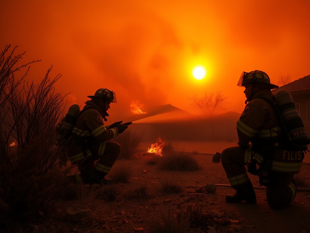
Phoenix firefighting crews battled the Horseshoe Fire, which broke out on the afternoon of May 7 near Horseshoe Lake in the North Valley area. The wildfire, which has burned about 300 acres and is spreading toward private properties and utility lines, prompted efforts to protect homes and infrastructure, officials said.
The Horseshoe Fire ignited on the afternoon of May 7, 2026, north of Phoenix near Horseshoe Lake in the North Valley region, according to multiple reports. The cause of the fire has not been determined and remains under investigation, officials said.
As of the latest updates on May 8, the wildfire has burned approximately 300 acres and continues to spread toward private properties and utility lines, raising concerns about potential damage to homes and critical infrastructure.
Phoenix-area firefighting crews have been actively engaged in ground operations since the fire’s outbreak, deploying multiple teams to contain the blaze and prevent its further expansion. Officials confirmed that the focus of response efforts is to protect residential areas and utility infrastructure threatened by the fire’s proximity. No specific fire agencies were named in initial reports, but local crews are working in coordination to manage the incident. Video footage and satellite imagery from the WFCA Fire Map show an active fire signature consistent with ongoing firefighting activities.
There have been no evacuations ordered, and no injuries have been reported, according to authorities monitoring the situation. However, the fire’s location near utility lines poses a risk of power outages if the flames advance in that direction. Smoke from the fire has been visible in the area, though no air quality measurements have been released. The terrain and fuel conditions in the North Valley, near the Tonto National Forest, contribute to the fire’s potential for growth, officials noted.
Arizona wildfire authorities are closely tracking the fire using satellite data and fire mapping tools. The WFCA Fire Map lists the Horseshoe Fire as active, marked with a red icon indicating ongoing spread. Updates on the fire’s status have experienced delays of one to three hours due to satellite data processing times, sources confirmed. There is no containment percentage available at this time, and crews continue to work under critical fire risk conditions reported by regional weather models.
The Horseshoe Fire is part of a larger pattern of wildfire activity in the region during the early May period, with dry fuels and weather conditions heightening the risk. The Scott and Burgan fuel models apply to the area’s vegetation, which can influence fire behavior and suppression strategies. While lightning threats have been forecasted for the region, officials have not linked any recent strikes to the ignition of this fire.
Authorities advise monitoring official channels for real-time updates, as firefighting efforts remain ongoing. The fire’s progression will continue to be assessed over the coming days, with priorities focused on preventing further encroachment onto private lands and protecting critical infrastructure in the North Valley area.
Comments are closed.