

Horseshoe Fire burns north of Phoenix area with crews working to protect utility lines and private properties
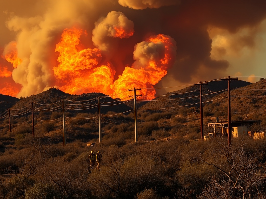
The Horseshoe Fire burned about 300 acres northeast of the Phoenix metropolitan area on Tuesday, officials said. Crews worked to protect utility lines and private properties as winds near 10 mph drove the fire’s moderate to high rate of spread, according to U.S. Forest Service updates.
Officials reported that winds near 10 mph have contributed to a moderate to high rate of spread, pushing the fire’s growth throughout Tuesday. The fire’s progression has prompted crews to focus efforts on protecting nearby utility lines and private properties in the affected region.
The fire, located northeast of the Phoenix metropolitan area, has rapidly expanded to approximately 300 acres, according to updates from the U.S. Forest Service.
Fire response teams, under the direction of the U.S. Forest Service, have been actively engaged in containment and protection operations. According to incident overviews from Watch Duty, resources have been deployed to the fire perimeter to safeguard critical infrastructure and residential areas threatened by the blaze. The WFCA Fire Map, which provides real-time tracking of the incident, confirms the deployment of firefighting personnel and equipment concentrated around vulnerable locations within the fire’s path.
The Horseshoe Fire’s location and size have been consistently reported across multiple sources. Records from the Daily Dispatch and Watch Duty align with the Forest Service’s assessments, confirming the fire’s footprint at about 300 acres. The fire’s northeast positioning relative to Phoenix places it within a region where utility lines and private properties are at risk, necessitating the focused response efforts.
Wind conditions have played a significant role in the fire’s behavior. Multiple sources, including the U.S. Forest Service, Watch Duty, and WFCA Fire Map, report sustained winds around 10 mph. These winds have facilitated the fire’s moderate to high rate of spread, accelerating its expansion and complicating containment efforts. No additional weather data, such as humidity or temperature, were provided in the current updates.
While the exact number of personnel and resources on scene has not been quantified in publicly available reports, Watch Duty’s incident overview indicates active engagement by firefighting crews. The U.S. Forest Service continues to lead the response, coordinating efforts to limit further spread and protect critical assets within the fire’s vicinity.
No containment percentage has been released as of the latest updates, reflecting the ongoing nature of the response. The fire’s rapid growth and the influence of wind conditions underscore the challenges faced by crews working to control the blaze.
The Horseshoe Fire is one of several incidents monitored in the region, with real-time mapping and tracking provided by platforms such as WFCA Fire Map and Watch Duty. These tools assist officials and responders in managing resources and communicating fire status to the public.
Officials have not released specific names or detailed personnel information related to the incident. Updates will continue as conditions evolve and further assessments are made regarding containment and impact on the surrounding communities.
Comments are closed.